Selected Environments
Day-to-day LGSVL production work lives in confidential project files, but LG publicly released a set of simulation maps as part of the simulator’s open-source content library. The renders below are pulled from that public release, so they can be shown directly rather than described secondhand.
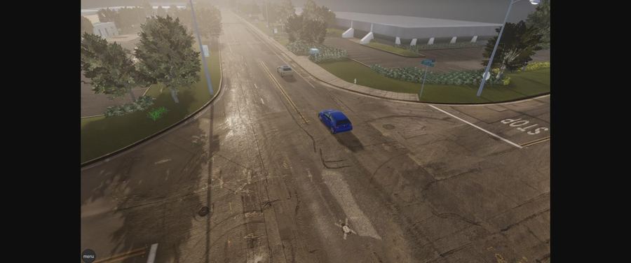
Borregas Avenue
Sunnyvale, CABuilt end to end from LiDAR scan data captured on site with an engineering partner — texturing, all assets, Unity setup (colliders, materials), and HD-map annotation for lanes and traffic signals.
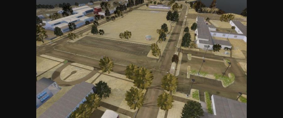
GoMentum Station
Concord, CASame full-pipeline scope as Borregas Avenue — LiDAR capture through texturing, assets, Unity setup, and lane/signal annotation — for a closed AV proving ground on a former naval airstrip.
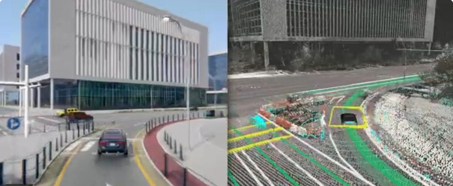
Magok LG Science Park
Seoul, South KoreaRendered scene paired with the underlying LiDAR point cloud and lane/vehicle annotation used to build it — LG’s own Seoul campus, reconstructed end to end.
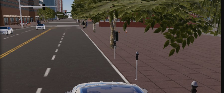
San Francisco / SOMA
San Francisco, CARebuilt from the ground up to replace an earlier version that had grown too dense and disorganized to run reliably — new assets, Unity setup, and annotation throughout.
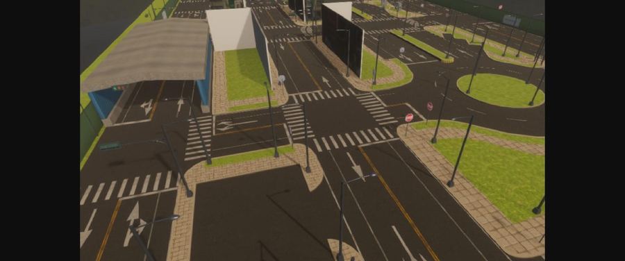
Shalun
Tainan, TaiwanA signalized multi-approach test intersection for Taiwan Car Lab, rebuilt to replace an earlier version — full assets, Unity setup, and annotation.
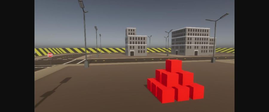
CubeTown
SyntheticA blockout test environment for early sensor and vehicle-dynamics validation, rebuilt to replace an earlier, overly heavy version.
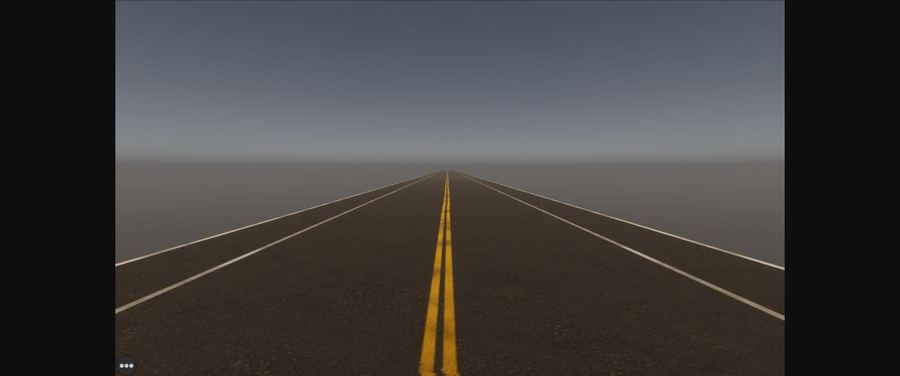
Single Lane Road
SyntheticA minimal two-way road built on short notice for a team that needed a clean, single-variable test case.
These environments were released by LG as open-source content for LGSVL Simulator and remain publicly available for verification (see references).
Project Overview
At LG, I worked on LGSVL Simulation, a real-time autonomous-driving simulation platform used to develop and test autonomous vehicle systems in controlled virtual environments. It combined detailed environments, roads, traffic elements, vehicles, sensors, and reusable assets for simulation workflows.
Environment production required a balance of geographic and visual accuracy, reliable road layouts, realistic context, and efficient real-time performance.
My Role
I created and optimized large-scale real-time environments and reusable 3D assets using LiDAR, photogrammetry, reconstruction data, reference photography, and Unity-based production workflows.
My work combined environment art, technical art, asset optimization, and collaboration with engineering and simulation teams to support realistic and dependable autonomous-driving scenarios.
Key Contributions
- Owned the LiDAR-to-simulation reconstruction pipeline: converted raw LiDAR scans into textured meshes with per-point RGB color in 3DF Zephyr, then rebuilt clean topology and proper UVs in Maya and transferred the captured color data onto the new mesh.
- Refined captured textures in Photoshop for photorealistic accuracy, and processed and validated point-cloud and LiDAR data using tools including ReCap Pro, Agisoft, RealityCapture, 3DReshaper, CloudCompare, and VeloView.
- Assembled and dressed large-scale environments in Unity — placing collision geometry, vegetation (multiple SpeedTree tree variations positioned to match real-world reference), and roadside elements such as signs and traffic signals.
- Authored road, lane, stop-line, and traffic-light setup for autonomous-driving scenarios using Unity-based HD-map and lane-editing tools, then handed off finished environments to the engineering and simulation teams.
- Created reusable roads, buildings, vegetation, props, and supporting environmental assets across Maya, 3ds Max, Blender, and Houdini.
- Cleaned, rebuilt, and optimized geometry, materials, textures, collision, and level-of-detail assets for reliable real-time performance.
- Balanced environmental accuracy, visual quality, and runtime performance across large scenes.
- Collaborated with engineering and simulation teams on technical requirements and scenario support.